


135 Days on the Road
Wakatipu Basin, we are going to explore you like never before! We are swapping the pain-in-the-ass that we call our campervan and getting into a 4×4 truck that’s going to take us to places we never knew we could go! (Nor wanted to drive ourselves to). The Arrow River, The Kawarau River, Coronet and the renowned Skippers Road: we’re seeing it all today!
We are picked up bright and early this morning right in front of the Nomads Hostel by our Nomad Safaris‘ guide, Laura. (This is not going to get confusing at all). We just have one more stop to pick up some American students, then we are hitting the road!
A safari with a personal touch
Introductions made, Laura gets straight into it as we leave Queenstown and head up east along Lake Wakatipu, throwing all sorts of fact bombs our way. As she is a Queenstownie born and bred, she knows HEAPS about the area!
For a more personal touch to our tour, she asks us what we prefer to focus the tour on: more about the history of the area or more about The Lord of the Rings filming locations. The group votes for a unanimous history lesson, however, Lord of the Rings’ locations will be thrown in there from time to time, starting with the Kawarau River!
A Lord of the Rings’ location
Instead of parking up at the historic Kawarau Bridge bungy jumping site, like we have done so many times before, Laura takes us up a gravel road to get a whole new perspective of the Kawarau River. We get an awesome view of the blue waters and deep river gorge and a look at the very spot where part of The Fellowship of the Ring was filmed. This is where the Fellowship pass two towering statues of Aragon’s ancestors in canoes. Much to our disappointment, the statues are not here to welcome us. (Damn you, special effects)!
To help us visualise the scene, Laura holds up a printed screenshot, then helps take any token photos needed for this famous Lord of the Rings location.

Winding up the Crown Range
At each stop we take along the way, we are encouraged to swap seats so everyone can get different perspectives throughout the tour. And beside, no one likes the middle back seat!
After a reshuffle, we are back on the road heading up the zigzagging road to the Crown Range – the road we arrived in Queenstown from the other day. Man, this road feels so much better when someone else is driving – driving a 4×4 truck for that matter.
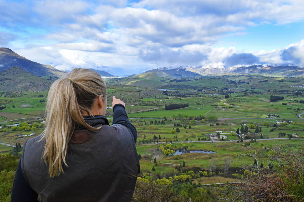
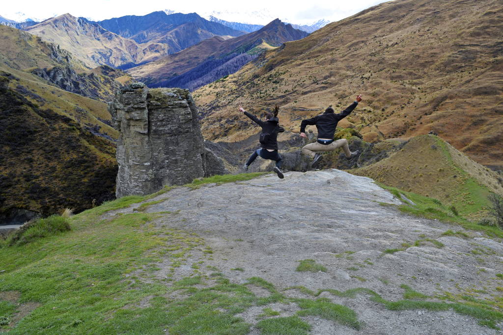
New perspectives on the Wakatipu Basin
But, instead of heading back to Wanaka, we take a secret side road to a viewpoint away from the tourists. Below us is the wee town of Arrowtown. This is also our first real glimpse of the landscape in terms of vegetation. Out of the entire Wakatipu Basin of Arrowtown, Lake Hayes and Queenstown, only a small mountainside to our right is covered in it’s original forest. The rest is farmland or pine trees made to look like England thanks to some of New Zealand’s early pioneers. On one hand, it’s a pretty sight. On the other, it’s completely out of place and has come at the expense of New Zealand’s original beauty.
A bumpy ride
Until this point, the use of a 4×4 truck has not really been necessary taking sealed road and well-maintained gravel roads. Oh, how that’s all about to change!
Laura shows us what this 4×4 is made of by going downhill on the bumpiest pothole-riddled 4×4 track! We bounce our way down to Arrowtown, stopping every so often for hikers using the more common method of getting up this hill.
But wait, isn’t Arrowtown bordered by the Arrow River on this side of town? We think you can probably guess that that doesn’t matter!
Dramatic clouds over the Wakatipu Basin
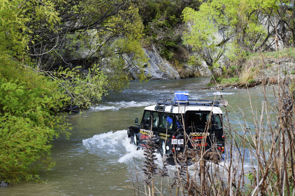
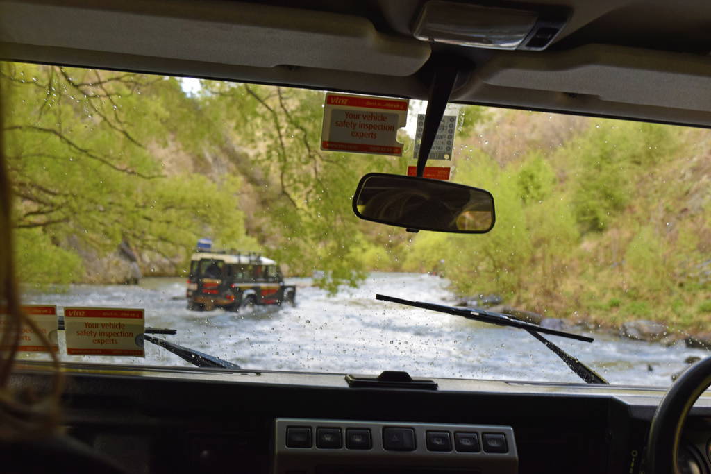
The Arrow River highway
“This isn’t a river. It’s a creek!” Laura exclaims as she puts power to the pedal and blasts through, water splashing in waves right over the bonnet/hood of the truck. Laura assures us that there will be about 14 more crossings like that.
After a quick run around the town and that all-necessary toilet break, we pretty much use the Arrow River as a highway. In fact, as we catch up with the tour of Nomads Safari trucks ahead of us, it is like a highway!
Some of us laugh hysterically, while others keep quiet as they are probably thinking: “What the f*ck?!” as the truck manically bobs up and down over the river bed. Water is splashing up the sides and over the front as we indeed cross the river about seven times on the way down the river and seven on the way back, stopping for some 4×4 synchronised swimming with the other trucks halfway through.
Panning for gold
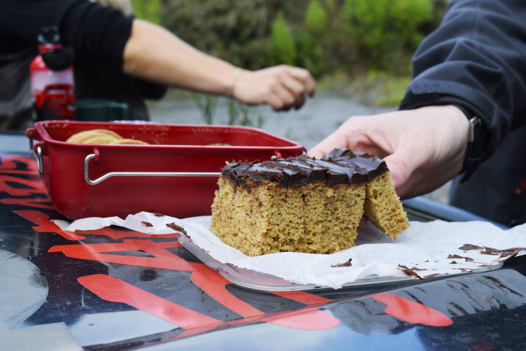
On the way back down the Arrow River, the truck parks up on the side of the river for morning tea and gold panning. Laura demonstrates how to gold pan then leaves us to it as she puts together some hot drinks and some sweet things.
We swirl the black sand and river water in our gold pans desperately trying to spot a sparkle of gold. Today could be the day we make our fortune! Laura, as in our Laura, as in the one writing this blog post now, is left with nothing but an array of colourful rocks in her pan. (Someone wasn’t listening to the instructions). While teacher’s pet, Robin, has a couple of gold particles probably worth 20 cents. Wahoo!
We mock each other over chocolate banana cake, coffee and cookies.
One of the world’s most dangerous roads
Back in the Nomads Safari truck, we are finishing those river crossings, Laura giving us tips on how to drive through a river along the way. Our next destination is the Skippers Road, which was once named one of the world’s most dangerous roads! (Now you can see why we wouldn’t dream about taking out camper down here).
The Skippers Road just happens to start from another awesome vantage point of the Wakatipu Basin, where Laura can point out all the places we have been to.
Signs of warning mark the entrance of Skippers Road, but hell, this truck has just proved it can go anywhere! Let’s do this!
Mountainside straddle
The single lane gravel road straddles the mountain side with nothing but a sheer drop below us. Nevertheless, the views are incredible with tussock-covered mountains and snowy peaks in the distance. There are even some crazy rock formations of all kinds of shapes: a lighthouse, King Kong and whatever else your imagination can spruce up.
The Welcome Home Pub
As we drive down, the weather dramatically changes to big chunky raindrops, just in time for us to get out of the truck to see the remains of The Welcome Home Pub – just two chimneys… This was a rest stop for the gold miners as they made their way back to civilisation. As you can imagine, Laura tells us a few funny stories that used to happen in this pub, such as the quest to find ugly bar maids.
On the way back up Skippers Road we get more opportunities for photos, while Laura continues to share her impressive knowledge of the area, as she has been doing this whole trip! Not only is it hard to find a local in the touristy town of Queenstown, but we’re thankful to find a local who has a passion to share the stories of this famous town!
Gearing up for the season ahead
The end of the Skippers Road marks the end of the tour, where Laura arranges where to drop us off in town. For us, it’s Torpedo7 where we have a date with its outdoor activewear. We seriously need to stock up on trail runners, light merino wool layers, backpacks, shorts, socks and whatever else for summer!
Tomorrow, join us down the Skippers Road once again! That will just be the first part of an adrenalin-fuelled day jet boating in the Skippers Canyon. See you then!
Laura shows us the GNARLY Skippers Road
Theta 360 Loading...
Want more?
Awesome! Give these articles a cheeky old read:
- 23 Lord of the Rings Locations You Can’t Miss in New Zealand
- 15 Free or Cheap Things to do in Queenstown
- Queenstown – Guide for Backpackers
Until tomorrow’s post, give us a like of Facebook for daily travel tips and a follow on Instagram.
See you tomorrow!


